Aerial Drone Filming and Photography in Kent
As an extension of our media services we are fully licensed by the CAA to conduct aerial photography and film work utilising our state of the art drones. Being specialists in video production we have the knowledge and expertise to provide beautiful imagery in the highest 4K quality.
We're based in Whitstable and work throughout Kent and the South East.
Aerial Video & Filming
With over 10 years experience in video production aerial cinematography is second nature to our team. Our expertise in this area allows us to achieve the best results when filming with the drones. We utilise a dual operator set up when required, allowing independent control of the camera. This produces the most dynamic shots and offers increased safety when flying in high risk or restricted areas. We are approved by the CAA to request air space reservations, meaning a reduced risk of other air users unintentionally ruining the shot.
Aerial Photography
Drones have reduced the cost of aerial photography and opened it up to a whole new range of industries. Being able to deploy rapidly and in tighter locations than traditional helicopters. Our enthusiastic team will work with you from start to finish to achieve the best results. Some applications include advertising, residential and commercial property marketing, corporate and sports events. Our design expertise means we can assist with any post production editing, or work with your existing photographer or art director.
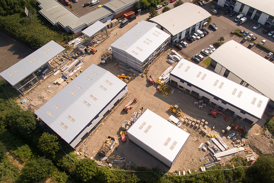
Aerial Surveying & Mapping
UAVs provide a quick and inexpensive solution for aerial surveying, eliminating the need for expensive and often time consuming scaffolding. The live feed from the drone can be viewed on site by the surveyor who can direct and zoom into any problem areas they see. Images and video are saved for future reference and planning. The high quality 4k footage enables users to zoom in and view in closer detail without distortion.
Applications: Environmental, Utilities, Renewables, Telecommunications, Construction, Maritime
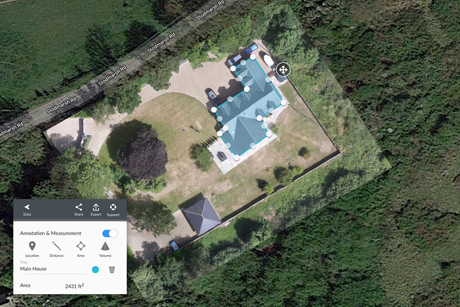
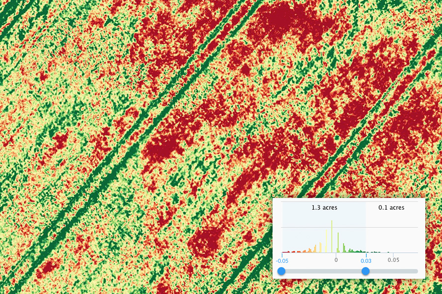
Web-based Delivery
Our drone systems allow us to visually map construction sites and environmental areas in ultra high detail, a process that traditionally would be highly expensive and time consuming. We can create 3D models for site planning with accurate measurement and volume inspection tools. Our data is exportable and compatible with existing software integrations (BIM, CAD, GIS).
Safety
Although drones are incredibly reliable they do pose a risk and we have taken great care developing our safety procedures. We are fully licensed by the CAA (Civil Aviation Authority) to operate drones or UAVs in Kent and across the country. Anyone doing commercial work without a PFCO would be doing so illegally and uninsurable. Our Pilots are BNUC-S qualified and are required to undertake multiple tests to gain their license. We are insured by Allianz who are the world's largest aviation insurer. Public liability cover can be up to 10 million.
A Complete Digital Agency
Realising Design’s post production facilities allow us to offer unrivalled support from our agency team. Our hard working crew can help also assist with aerial surveys and mapping. We have in house data experts who can manipulate and visualise data captured in ways others simply can’t, allowing you to view your site and land surveys in minute detail.
"We used Realising Designs to provide some aerial photography and video of a corporate open day we were running. This formed part of a social media campaign and the photos from the drone were particularly well received. I look forward to working with you all again on future projects."
Claire Smith
Grow your digital and realise your potential